Hamama
حمامة Hamameh[1] | |
|---|---|
 People of Hamama with governor Aref al Aref and Julian Asquith, in 1943 | |
| Etymology: "dove"[2] | |
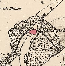
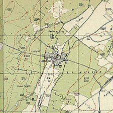
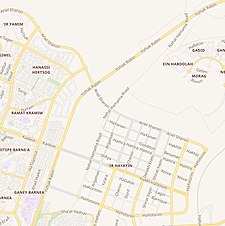
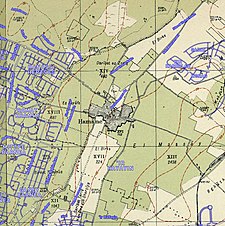
A series of historical maps of the area around Hamama (click the buttons) | |
Location within Mandatory Palestine | |
| Coordinates: 31°41′35″N 34°35′32″E / 31.69306°N 34.59222°E | |
| Palestine grid | 111/122 |
| Geopolitical entity | Mandatory Palestine |
| Subdistrict | Gaza |
| Date of depopulation | 4 November 1948[5] |
| Area | |
| • Total | 41,366 dunams (41.4 km2 or 16.0 sq mi) |
| Population (1945) | |
| • Total | 5,070[3][4] |
| Cause(s) of depopulation | Military assault by Yishuv forces |
| Current Localities | Nitzanim,[6] Beit Ezra,[6] Eshkolot[6] |
Hamama (Arabic: حمامة; also known in Byzantine times as Peleia) was a Palestinian town of over 5,000 inhabitants that was depopulated during the 1948 Arab-Israeli War.[3][4] It was located 24 kilometers north of Gaza. It was continuously inhabited from the Mamluk period (in the 13th century) until 1948.[7]
its ruins are today in the north of the Israeli city of Ashkelon.
- ^ Conder and Kitchener, SWP II, 1882, p. 418
- ^ Palmer, 1881, p. 267
- ^ a b Government of Palestine, Department of Statistics, 1945, p. 31
- ^ a b Government of Palestine, Department of Statistics. Village Statistics, April, 1945. Quoted in Hadawi, 1970, p. 45
- ^ Morris, 2004, p. xix, village #286. Also gives the cause of depopulation.
- ^ a b c Khalidi, 1992, p. 100
- ^ Marom, Roy; Taxel, Itamar (2023-10-01). "Ḥamāma: The historical geography of settlement continuity and change in Majdal 'Asqalan's hinterland, 1270–1750 CE". Journal of Historical Geography. 82: 49–65. doi:10.1016/j.jhg.2023.08.003. ISSN 0305-7488.
© MMXXIII Rich X Search. We shall prevail. All rights reserved. Rich X Search


